Show Google Maps Directly in SharePoint Lists - April 17, 2025
Introduction to Google Maps Integration in SharePoint
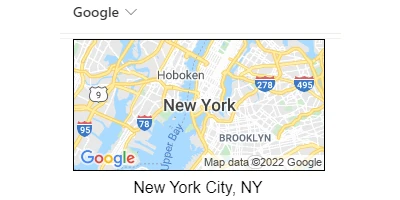
In today's digital age, data visualization plays a critical role in enhancing business processes and decision-making. One innovative approach to integrating visual status indicators and improving project and employee management is by leveraging Google Maps within SharePoint. Thanks to the SharePointDashboards.com Google Maps template, organizations can now embed interactive mini maps directly into SharePoint list views. This empowers users to visualize address information, offering a dynamic and intuitive geographical reference which significantly enhances data interpretation and utility.
Setting Up Google Maps in SharePoint
Implementing Google Maps in SharePoint is remarkably straightforward. To begin, you simply need to set up a column in your SharePoint list to store address-related information such as an address or postal code. By applying the Google Maps template from SharePointDashboards.com, a mini map is dynamically generated for each entry, displaying the respective location. Multiple configuration options are available, enabling users to control the size and style of the map according to their organizational needs.
The process requires no programming skills, making it accessible to users of varying technical expertise. By merely copying and pasting the template into the designated SharePoint list column, a Google map is instantly incorporated, providing a geographical lens through which data can be viewed and utilized.
Enhancements in Charting and Visual Status Indicators
Google Maps integration in SharePoint offers substantial advancements in charting and visual status indicators. Providing a visual representation of locations enhances traditional data tables by converting them into interactive, spatial data points. Users can easily click on any mini map to expand it in their web browser, gaining deeper insights into the pertinent location details and geography.
This visual status indication is invaluable for quickly assessing geographical trends and spatial relationships within datasets, such as customer demographics, regional project distributions, or delivery coverage areas. By replacing textual data points with visual indicators, users engage with data more effectively, improving comprehension and facilitating faster decision-making.
Implications for Project and Employee Management
In project management, geographical data plays a crucial role, particularly for businesses handling fieldwork, logistics, or regional operations. Embedding Google Maps in SharePoint allows project managers to monitor and track project statuses geographically. For instance, construction companies can display ongoing projects on maps, providing a visual progress report that enhances oversight and coordination.
Similarly, in employee management, companies with dispersed workforces benefit from mapping employee locations. Visualizing team member distributions fosters better resource allocation and task assignment, optimizing operational efficiency. Jacobs, a fictional transport company, uses this feature to manage drivers' locations, enhancing route optimization and client service.
Use Case Scenarios: Maximizing Maps for Enhanced Visualization
Numerous real-world scenarios illustrate the practical benefits of using Google Maps with SharePoint. Consider the following examples:
1. Sales Teams: A sales team can utilize maps to visualize client locations and sales routes, optimizing commuting tasks and enhancing customer engagement.
2. Event Management: Event coordinators can benefit immensely by plotting venues and participant origins on maps, ensuring smooth logistics and travel arrangements.
3. Compliance and Safety: Compliance teams in industries like healthcare or safety inspection can utilize maps to efficiently schedule site visits and ensure regulatory coverage.
4. Supply Chain Management: Logistics companies can map out supply routes and warehouse locations, facilitating improved inventory management and distribution strategies.
Leveraging SharePoint JSON Formatting
SharePoint JSON formatting plays an essential role in customizing how information is displayed within SharePoint lists. By applying JSON configuration to a list view, users can stylize data presentation, including the integration of Google Maps. This templated approach simplifies the configuration process, allowing organizations to effortlessly enhance their data displays.
The SharePointDashboards.com template taps into this capability, enabling users to create aesthetically pleasing maps that align with their organizations' branding and informational needs. The flexibility of JSON formatting ensures that the incorporated maps can be tailored to match specific visual and functional requirements, making this integration seamless and highly effective.
Conclusion: Transforming Data Interaction with SharePoint
Incorporating Google Maps into SharePoint through the user-friendly SharePointDashboards.com template represents a significant leap forward in how organizations visualize and interact with data. From enhancing charting capabilities to providing real-time project and employee management insights, this integration empowers users with a geographical dimension of data analysis that transforms traditional business operations.
By adopting this template, organizations can effectively turn raw data into meaningful, actionable insights that align with strategic goals, promoting efficient decision-making and operational excellence. Whether it's for internal project tracking or customer engagement strategies, the seamless integration of Google Maps in SharePoint is not just a technological convenience - it's a strategic necessity for modern businesses.
|